
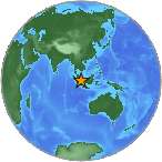
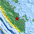
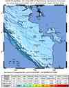
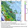
Magnitude 7.3 - SOUTHERN SUMATRA, INDONESIA
2004 July 25 14:35:18 UTC
Earthquake Details
- This event has been reviewed by a seismologist.
| Magnitude | 7.3 |
|---|---|
| Date-Time |
|
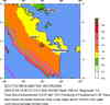
| Location | 2.455°S, 103.977°E |
| Depth | 576 km (357.9 miles) set by location program |
| Region | SOUTHERN SUMATRA, INDONESIA |
| Distances | 105 km (65 miles) NW of Palembang, Sumatra, Indonesia 105 km (65 miles) SSE of Jambi, Sumatra, Indonesia 415 km (255 miles) S of SINGAPORE 510 km (315 miles) NW of JAKARTA, Java, Indonesia |
| Location Uncertainty | horizontal +/- 5.1 km (3.2 miles); depth fixed by location program |
| Parameters | NST=334, Nph=334, Dmin=201.3 km, Rmss=0.86 sec, Gp= 40°, M-type=teleseismic moment magnitude (Mw), Version=S |
| Source |
|
| Event ID | uslial |
- Did you feel it? Report shaking and damage at your location. You can also view a map displaying accumulated data from your report and others.
Earthquake Summary
Felt Reports
Felt (IV) at Bengkulu and (III) at Padangpanjang. Felt (III) at Bandung, Bogor, Sawahan and Sukabumi; (II) at Jakarta, Java. Also felt (III) at Mataram, Lombok. Felt throughout Bali, Java, Lombok and Sumatra. Also felt in southern Johor, Malaysia and on Singapore.
Tectonic Summary
The earthquake occurred deep beneath the island of Sumatra, which is one of many islands in the large Indonesian island-arc system. Off the southwest coast of Sumatra, the Indo-Australian Plate subducts northwards beneath the Eurasian Plate at a rate of about 6 cm/yr. At the earth's surface, the boundary between the plates is marked by the 3400 km long Java (Sunda) Trench. The subducted Indo-Australian plate has previously been known to be seismically active to a depth of about 650 km beneath Java, but this magnitude 7.3 earthquake is one of the few to occur below 300 km beneath the island of Sumatra. Due to the earthquake's depth it was felt over a large area, but caused little damage.


Scientific & Technical Information

- Preliminary Earthquake Report
- U.S. Geological Survey, National Earthquake Information Center:
World Data Center for Seismology, Denver
