
- 1992-04-25 18:06:05 (UTC)
- 40.335°N 124.229°W
- 9.9 km depth
Interactive Map 
Regional Information Felt Report - Tell Us! 000108Responses Contribute to citizen science. Please tell us about your experience.
- Did You Feel It?
IXmmi 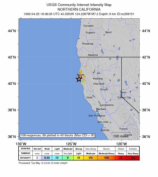
Community Internet Intensity Map - ShakeMap
VIIImmi 
Estimated Intensity Map Ground Failure - Landslide Estimate
Significant area affected
Little or no population exposed
- Liquefaction Estimate
Limited area affected
Limited population exposed
Origin - Review Status
- REVIEWED
- Magnitude
- 7.2 mh
- Depth
- 9.9 km
- Time
- 1992-04-25 18:06:05 UTC
Moment Tensor Fault Plane Solution View Nearby Seismicity - Time Range

± Three Weeks - Search Radius

250.0 km - Magnitude Range

≥ 4.0